• Skip to main content
  • Skip to header right navigation
  • Skip to site footer
Athelstan logo

Athelstan Museum

Capturing the history of Malmesbury

  • Visit
    • Opening Hours
    • Getting Here
    • Inside the Museum
    • Accessibility
    • Shop
    • Explore Malmesbury
  • What’s On
    • Current Events
    • Past Events
    • Exhibitions
  • Collection
    • Agriculture & Industry
    • Art
    • Coins
    • Highlights From Our Collection
    • Malmesbury Images
    • Malmesbury Voices
    • Textiles & Lace
    • Transport
  • History
    • Timeline
    • People
    • Architecture
    • Community
    • Witches of Malmesbury
    • Trade & Industry
    • Transport
    • Governance
  • About
    • Venue Hire
    • Our Museum History
    • Museum Organisation Structure
    • Museum Collection Policy
    • Museum Support
    • Volunteers
    • News & Newsletters
    • Useful Web Links
  • Learning
  • Support
    • Make a Donation
    • Become a Member
    • Corporate Sponsors
    • Legacy Donations
    • Fundraising
    • Volunteering
  • Contact
malmesbury abbey

Transport

charabanc

Malmesbury has missed out on transport links ever since stone age man chose the flat route to drag the Preseli stone to Stonehenge or did they float it round? Either way Malmesbury was not a stopping place.

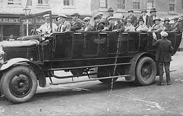
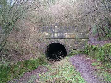
Today our railway has gone, our bus service is less than desirable but still underused and the car rules supreme. Saxon Malmesbury groans under the volume of traffic and heavy goods vehicles periodically rearranging the market cross and war memorial.

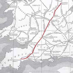
Although Malmesbury itself is a motorist’s nightmare, it is paradoxically well placed for travel. The M4 and M5 both lie within easy reach giving easy access north, south, east and west.

Kemble, seven miles away to the north is a civilian airport but there is no commercial traffic. Lyneham, the same distance south east is one of the RAF’s most used airfields, but is threatened with closure in 2012. Numerous other airfields are in the area but all are relics of the second World War.

The pages here give some insight into what was and what might have been.

malmesbury station

Rail

foss way

Road

La Belle Sauvage

Vehicles

sapperton canal tunnel

Water

m

Heritage Fund Logo
ArtFund Logo
South West Museum Development Program logo
European Flag

The European Agricultural Fund for Rural Development: Europe investing in rural areas

Defra Logo
Wiltshire Council logo
Vale Action
Leader logo
athelstan logo

Athelstan Museum
Town Hall, Cross Hayes
Malmesbury
Wiltshire, SN16 9BZ

Tel: 01666 829258
Email: info@athelstanmuseum.org.uk

  • Facebook
  • X

Copyright © 2026 · Athelstan Museum Malmesbury| Registered Charity: 1174110 | Data Protection Policy | Website Accessibility | Site Map | Website by Callia Web